Wednesday, August 13, 2025

Chapter 25. To Chengdu across the Long March grasslands 红原 - 查真梁子 - 黑水 - 茂县

It’s one thing to take an e-bike to the headwaters of the Yellow River, but quite another to get it back again. One of the reasons I chose to make the First Bend the ultimate goal and endpoint of my trip was because I could take my bike from there into Sichuan, where I had friends who could store the bike for me. 

So from the First Bend I embarked on a four-day journey through the grasslands and mountains of northern Sichuan to get to the provincial capital.  My last view of the Yellow River was when passing through Tangke (唐克), a scruffy riverside town that had little to recommend it. I made a detour across a bridge over the White River (白河, Baihe) for a few kilometres to the west of town to see what the road looked like going upstream. 

After passing a large field of yellow rapeseed, the road petered out into a dirt track that ran through farmland flood plains. The river here changed its course frequently. On the map, I could see ‘ghost’ loop images indicating where the river had previously run. The route upriver looked desolate, especially in the rain. 

 My journey to Hongyuan (红原) took me across Tibetan grassland plains beside the Bai river. The rainy season had set in, and I became accustomed to pedalling in the wet. Along the roadside, there were many more Tibetan tourist businesses, all offering the same range of horse rides, ATVs, honey for sale, yak meat barbecues, and rows of cabins and tents. There were Long March memorials, Tibetan Buddhist chortens, and car wrecks displayed as public warnings against traffic accidents (‘9 out of 10 crashes are caused by speeding!’). 

 Hongyuan was a mess because the entire main street was closed off for reconstruction. I squelched my bike through a muddy diversion and found a room in a tatty Tibetan-run hotel with a friendly receptionist.  

On the second day of cycling through the rainy plateau south of Hongyuan, I pedalled up a long incline to a 4350-metre pass called Chazi Liangzi (查真梁子). The signs proclaimed it to be the place where the watershed of the Yellow River met with that of the Yangtze.  

“Standing on the ridge and looking down, you can enjoy the two very different landforms of the Yangtze River and the Yellow River at the same time, and enjoy the two different landforms of mountains and grasslands,” it said. Or as my Chinese friend put it: Have a piss in one direction and it goes into the Yangtze, in the other to the Yellow River.

Sure enough, there were mountains ahead, albeit covered in rainclouds. 
 
As I descended, I left the grasslands— and the Yellow River— behind me. After one more climb to a tunnel through the Qionglai mountain range, it was downhill all the way from there to Chengdu. I took the road down to Heishui (黑水), following the course of the Black River, which was in flood. The Aba Tibetan houses here were built of stone and looked like chalets from the Alps. To the south were the famous peaks of the Sigunian Range, and I bypassed turnoffs to see glaciers and more Long March monuments. 

 Here was tourist infrastructure: the road had cycle paths in some sections, and Heishui town had boutique hotels— but I was not yet home and dry. The rain continued the next day, and the river was in even greater flood. The road south was blocked by landslides due to the rain, and I had to wait an hour in a line with a lot of impatient Chinese car drivers for a bulldozer to clear a way through. 


When I joined the busy highway that linked Jiuzhaigou to Chengdu, the real traffic nightmare began. It was a narrow, twisting road with no shoulder and many blind corners. I spent so long pausing to let passing traffic go past that it took me two hours to cover the last 30 kilometres into Maoxian. 

With the rainy season now providing a steady daily downpour, the Min River en route to Chengdu was in full flood. The highway made numerous crossings of the river, whose waters piled up in alarming surging waves against the bridge supports, and I worried this would lead to the road ahead being closed. What I should have worried about were the tunnels. uld lead to the road ahead being closed. What I should have worried about were the tunnels. 

From Maoxian (茂县), the road south passed through Wenchuan (汶川), the epicentre of a 2008 Sichuan earthquake that killed 69,000 people. When rebuilding the roads devastated by landslides, China’s civil engineers had bored a series of tunnels through the mountains to bypass the landslide areas. Four of these tunnels were more than two kilometres in length, and one was a whopping 4.7 kilometres. There was only a narrow shoulder, and some sections were unlit, which meant pedalling in complete darkness with just a weak bike light to illuminate the way ahead. I was terrified.

The road was wet, and there were ruts and potholes in the surface that were hard to see and threatened to unseat me. Not to mention my worries about carbon monoxide from exhaust fumes, it was terrifying to have three or four trucks approach from behind you. When I saw the headlights, I would pull over and huddle in as close to the tunnel wall as possible until the monsters had roared past. I dropped my precious hat somewhere in the tunnel and was too scared to go back for it.

It could have been worse, though - I later learned that the nearby Shiziping tunnel on the highway from Wenchuan to Maerkam is more than 13 kilometres in length.

After my tunnel ordeal, I arrived in Dujiangyan a nervous wreck, spending the last few kilometres yelling at cars for being too close when passing me. Perhaps it was the anticlimax of no longer having a goal after three months of following the river - I needed a break.


First Bend of Yellow River to Chengdu, via Dujiangyan (click on image to enlarge)

Tuesday, August 12, 2025

Postscript: final thoughts on my Yellow River cycling trip

There were three things that stood out for me during this extended bike ride along the Yellow River: how ‘green’ China was, the scale of the infrastructure changes, and the rise of ‘middle class’ China.

As I have mentioned many times in my account of this trip, I saw a huge amount of ‘green’ development in China: solar panels everywhere, wind turbines on so many hills, and a general sense of improvement in the state of the environment compared to the trips I made ten years ago. That’s not to say that China has become the new Switzerland - there were still plenty of instances of pollution and garbage. But I was pleasantly surprised by how things like river water quality seem to have improved in recent years. 

I expected to be plagued by air pollution and industrial smog during my trip across the North China Plain, but was fortunate to enjoy weeks of clear blue skies and never felt the need to wear a mask. Perhaps the widespread adoption of electric vehicles and scooters has eliminated much of the exhaust pollution.


In terms of infrastructure, I was already well aware of the amazing network of high-speed trains, which I made full use of on this trip. As well as witnessing the frequent services running on the high-speed rail lines that I rode past on this journey, I also, of course, saw the construction of new lines in remote areas along the course of the Long March. 

I also saw other massive infrastructure projects such as highways, hydro dams, and tunnels. As a tourist, I saw the huge investment being put into tourism infrastructure such as the ‘holiday villages’ and visitor centres in the most remote areas. New infrastructure was also noticeable at a local level, with small towns and even remote Tibetan grassland villages having undergone upgrades in landscaping, parks, and amenities such as playgrounds and picnic areas.

This brings me on to the third point, which I have already discussed in some detail: the development of a ‘middle class’ China. What I mean by this is the rise of an affluent class of individuals who have disposable income and also time to pursue leisure and lifestyle interests. Until about ten years ago, most people in China seemed to be just getting by, with just a small minority of ‘nouveau riche’ in the big cities showing off their wealth with Western designer brands. 

Now the affluence has trickled down to people in provincial backwaters such as Xixian in Shanxi, where locals enjoy eating at outdoor ‘street restaurants’ with a selection of craft beers. And of course, the levels of the Chinese domestic tourism market have boomed, meaning that China no longer seems interested in pandering to foreign tourists. I saw few on my trip except in the world-famous sites such as the terracotta warriors in Xi’an.


One thing that did puzzle me about China was the sheer level of ‘overcapacity’  - for want of a better word - across many aspects of the tourism sector. 

There seemed to  be a widespread build-it-and-they’ll-come policy, like the empty hotel complex at Hanggu Guan in Henan or the 700-kilometre ‘Yellow River Number One Tourism Highway’ on which I seemed to be the only user. On the Qinghai grasslands, I cycled past scores of local tourist fun park enterprises that all offered the same things: cabin and tent accommodation, horse riding, ATV rides, and local cuisine. Hardly any of them had any customers. How do they stay in business, let alone make any return on the investment? I thought the same thing when I saw local people selling fruit and vegetables by the roadside. How do people survive when they are selling commodities such as cherries, honey or watermelons when they seem to have no customers? I’m not an economist or social scientist, and I have no answers.

This trip to China challenged some of my expectations about the country. Before setting out, I had a few worries, such as whether I would be able to find hotels to accept me in off-the-beaten-track areas. That did not prove to be much of a problem. I was turned away by a couple of hotels but was easily able to find alternative options. 

Similarly, I was worried about encounters with police— being banned or expelled from certain areas or, worse, being arrested as a spy. The official advice from the Australian government travel website was that I should exercise a high degree of caution because I could be detained on the grounds of 'endangering national security'. It said: “Australians may be at risk of arbitrary detention or harsh enforcement of local laws, including broadly defined National Security Laws.”

In reality, I had no problems with police or any other form of authority during my stay in China, except for the obvious one of being turned back by traffic cops on the highway to the new dam construction site. I had no interactions with police: no knocks on the door of my hotel room to check my details, no police checkpoints on the road, and no instances of being stopped and questioned. 

Of course, China is a surveillance state— security cameras were everywhere, but this was something I learned to take for granted. The other side of this was that I had no security worries about personal safety or crime during the trip. People were generally friendly, helpful, and honest— I never felt threatened or experienced harassment. I took common sense precautions against theft: locking my bike up and keeping my valuables safe in a money belt. The only scare was when I lost my phone, and it was returned to me by the road construction gang who found it. 

What of the river itself? Seeing it in reverse, so to speak, made me appreciate what a major river it is, from the sea outlet right up to the headwaters at almost 4000 metres in altitude. I was puzzled by how the river is not consistently ‘yellow’ or silty, with some sections of its middle reaches in Gansu (Kanbula) and Shanxi (Hukou Falls) being unusually clear or green water. I was also surprised by how few boats there were on the river. Unlike the Yangtze - or even the Mekong - the Yellow River has been too shallow to be navigable for all but the most shallow draught of vessels.


The Yellow River was a source of food for many locals. I don’t know how much pollution there is in the river, but whatever the level, this did not seem to stop people catching and eating the famous carp and sometimes the fake salmon. Its waters provide irrigation for large sections of Inner Mongolia, where, like the Nile in Egypt, the river is a ribbon of green through the desert.

As an amateur ornithologist, I was impressed by the large number of birds - and wide variety of species - that I saw along the river. I’m no naturalist, so I can’t speak for the animal and plant life along the way, but I never expected to see marmots and camels on my journey.

For me, the most notable thing about my river trip was the variety of people I met along the way. The friendly and noble Shandong natives, the larger-than-life characters of Inner Mongolia, the Hui and Salar Muslims of Ningxia and Gansu, and of course, the Tibetans of Qinghai. 

Almost everyone I met was friendly and helpful— and all too willing to chat. With few foreign tourists visiting the Yellow River, the locals were pleased to see me and eager to tell me about the local places of interest.  And of course, with a wide variety of people and cultures comes a wide variety of food. Travelling the Yellow River would be a foodie’s delight— from the seafood of Shandong to the Hui dapanji. And a big change from usual south China dishes I was so accustomed to.

Travelling the Yellow River challenged a lot of my perceptions about China.  Like many Westerners, my impressions of the country had been formed based on experiences of regions of southern China such as Guangdong, Yunnan and Sichuan. Most of our news about China seems to relate to areas south of the Yangtze, whether it be Shanghai, Fujian, Guangzhou or Chongqing. For me, China was a country of rice-growing Han Chinese living in subtropical areas: traders who had links (and migration) to south-east Asia and the rest of the world via ports such as Hong Kong and Xiamen. 

Travelling the Yellow River made me realise there is another China that is almost a mirror image of the south: fields of wheat instead of rice,  sheep and horses instead of pigs and oxen. While south China saw an outward flow of Chinese moving to other parts of Southeast Asia and beyond, the Yellow River had the opposite. With its connections to Central Asia and the Middle East via the Silk Road, the Yellow River regions experienced an inflow of migrants who formed diverse communities along the river, such as the Hui Muslims of Ningxia, and the Christian and Jewish communities of Xi’an and Kaifeng. The Yellow River’s Mongolian links also brought in ‘Bannermen’ and even Bonan Muslims descended from Mongol settlers who later converted to Sunni Islam.

The Silk Road was the route by which Buddhism entered China, to be established at monasteries along the Yellow River in places such as Luoyang and Shaolin.

With its source in the Amdo Tibetan region of Qinghai, the Yellow River also has strong links to Tibetan Buddhism. 

This mixing of different ethnicities along the Yellow River was still notable in Qinghai, where I saw Hui Muslim and Tibetan women sitting side by side on tractors as they went to work out on the fields. 

With hindsight, I wish I’d done more research into the history of the Yellow River before embarking on the ride. I wish I’d known in advance about the lost civilisations of the Tanguts before visiting Yinchuan, and about the more recent history of the Long Marchers along parts of the Yellow River. Visiting the museums in places such as Kaifeng and Luoyang made me realise that the river gave birth to major cities and infrastructure projects in ancient times - the Great Wall, of course, and the complex irrigation and flood defence systems. The river was also the place where powerful armies fought - the charioteers and archers of Qin Shihuang, the cavalry of the Tanguts, and the merciless Mongol hordes of Genghis Khan. 

The scenery along the Yellow River was impressive, but I must say I found the desert and loess landscapes rather intimidating. Of course, my main regret was not being able to complete the last few hundred kilometres across the grassland plateau beyond the ’First Bend’ of the river to get to the source near Maduo in Qinghai. Maybe in a few years, there will be roads and hotels in that area so I can return to complete the journey. Similarly, the inaccessible gorge of the Yellow River above Lajjia remains to be explored.

In the meantime, I seem to be one of a lucky few outsiders who have travelled along much of the Yellow River. I’m surprised more people haven’t done the journey - it is, after all, one of the world’s greatest rivers. And unlike some of the others, such as the Amazon or the Nile, it is mostly accessible, affordable, and safe for travel. I look forward to reading the reports of others who go the same way.


Sunday, August 10, 2025

Cycling the Yellow River from sea to headwaters 骑行黄河,从入海口到源头


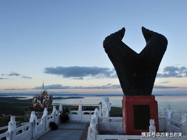
I've just arrived back in Sydney after completing my 5800km cycling trip up the Yellow River.  On 1 July 2025 I arrived at the 'First Bend of the Yellow River' (黄河九曲第一湾) near Ruoergai (Zoige) on the Qinghai-Sichuan border. I had originally intended to continue cycling a further 200km or so up to the town of Maduo, close to the source of the Yellow River. However, this is located in Golok country, which is closed to foreigners at the present time - I tried to reach it from the town of Gonghe in Hainan county, but was turned back by police at a road checkpoint just out of town on the way to Heke. Anyway, the headwaters at Jiuqu (Tangke) gave me enough of an impression of how the river is at 3500m altitude in the Tibetan grasslands.

My ride along the Yellow River took me three  months, starting in early April 2025, and travelling through the provinces of Shandong, Henan, Shanxi, Shaanxi, Inner Mongolia, Ningxia, Gansu, and Qinghai. The first section of the ride was done on a folding e-bike (Dahon Unio E20). This was OK for the shorter flatter sections in the Chinese plains, but I swapped it for a conventional size e-bike (a Giant Tour E+ 200) when I arrived in Xian after the first month. The new bike was much better sorted to to more hilly and rugged terrain heading in to Inner Mongolia, and I would never have completed the trip without its excellent 120km range powered by two batteries.

I experienced a wide variety of terrain, from the wheat fields and oilfields of the coastal plain to the epic canyons of the Yellow River along the Shaanxi/ Shanxi border, then the absolutely flat environment of the Mongolian grasslands and desert leading into the Muslim communities of Ningxia. After a break in Xian I continued up into the loess pinnacles of Gansu and ascended via the beautiful forests and rock formations of Kanbala to the large reservoir of Longyangxia and another canyon of the Yellow River. Along the way i saw a wide variety of birds (eg hoopoe), animals (eg marmots) and plants/flowers/trees.

The final stage of the trip was through more familiar ethnic Tibetan territory  in Qinghai, which I have visited before and described in the articles about Ragya monastery. Travelling from Linxia to Hezuo and the first bend of the yellow River was a challnge because of the high altitude and the threat of being attacked by the ever-present Tibetan dogs.

From the Zoige area I continued to Chengdu in Sichuan via Langmusi and the beautiful valley of the Heishui river to get to Maoxian and Wenchuan.

I had a great trip, staying in hotels along the way, all found and booked at very reasonable prices (15-200 yuan/night) via WeChat. Navigation was with AMAP (Gaode) app. I met lost of great people on the road and had no problems with authorities or security en route. I was surprised how easy and convenient it is to travel in supposedly 'off the beaten track' parts of China, because there is now a booming local tourism industry, with facilities and roads, hotels, restaurants etc to match. I was also surprised by the transformation of previously 'backward' places such as Linxia into modern and very livable cities.

I'll be writing up a fuller account of my trip over the next few weeks.

Wednesday, June 11, 2025

Yan Kunlong: Journey of Discovery


 I’m currently half way through my cycling trip along the Yellow River, just arrived in Lanzhou. Will do a summary post soon. 

While in Lanzhou I was privileged to meet Yan Kunlong (闫昆龙), author of Journey of Discovery (发现之旅) a great book describing the travels and works of western botanists in southern Gansu (Gannan) in the early 20th century. 

If you are interested in Frank Kingdon-Ward, Reginald Farrer and William Purdom, this is a wonderful read. It also has many great photos that make me want to travel to Gannan to visit these places. Meanwhile, I will continue my journey into Qinghai …

Monday, May 12, 2025

Yellow River cycling update: completed stage one


I've just finished the first section of my Yellow River cycling trip, starting at the river mouth near Dongying in Shandong province, and cycling through Henan to end up in Xi'an. 

It took me almost three weeks and I was riding a Dahon Unio E20 e-bike. I was able to average about 80km on the road each day, though some days stretched to 120km. It was mostly flat, so I didn't need to use the electric motor pedal assist much, except to take some of the strain off at the end of the day. 

I found the battery only had capacity for about 40-50km of range per charge, not the '100km' as claimed by Dahon. Nevertheless it is a good bike, proving a smooth ride, and of course I was able to fold it and take it on trains etc, to get to my starting point [although I have been advised that lithium batteries are not supposed to be taken on train].

I am travelling light and staying in simple hotels and guesthouses that I find [and book] en route by using the Gaode navigation app (in Chinese). Hotels are costing me about 140-240 yuan a night, and I've been using hostels where available in the bigger cities, for about 60 a night.

The highlights have been the historical and cultural sites in places such as Kaifeng, Luoyang, Qufu and the sacred mountains such as Taishan and Songshan. I will write up a full report at a later date but have been posting daily trip updates and photos on Insta and Facebook, which I'm sure you can find via search.

The next stage will take me another 100km up north to Inner Mongolia from the loess landscape of Shanxi into the desert around Ordos. This section intrigues me as few people travel this way and the river flows through the narrow and twisting Longmen gorge for hundreds of km.

So far I haven't been following the river closely because there simply aren't any roads or much to see along the lower reaches of the Huanghe. I expected it to be industrial and polluted, but it has been a mix or arable land (wheat and fruit) and a mix of oil derricks, power stations and wind trubines rather than heavy industry. And I've had blue skies almost every day, no smog.

I'll now be retiring the Dahon 20 inch wheel bike because I've found it's not suitable for longer distance heavy duty touring.  While it's a good bike, the addition of a heavy motor and battery to a conventional Dahon 'pedal' frame puts too much stress on the rear wheel spokes - I've had multiple breakages and loose spokes, that I've been able to fix thanks to the proximity of Dahon dealers in most cities. But from here on I'll be in more remote territory and don't want to hear the dreaded twanging sound when I'm hundreds of kms from a bike mechanic.

I'm looking at getting a larger bike in Xian this week - likely a Giant Tour E+

Watch this space!

Thursday, February 27, 2025

Next trip: cycling the Yellow River from sea to source


Looking for a new challenge and somewhere different from the usual Joseph Rock areas of south-west China, I've set my sights on cycling the Yellow River.  It offers a wide variety of terrain and cultures, from the Tibetan highland grasslands of Qinghai, down through the eroded loess clay of Gansu with many Hui Muslims, then an enormous loop up north into inner Mongolia, and back down into Shaanxi, where it turns east and flows through the historic cities that were the cradle of Han Chinese civilisation to the sea outlet in Shandong.

It's 6000 km in length and as far as I can tell no foreigner has yet DONE the Huanghe from end to end in its entirety. An American academic called Bill Porter travelled along the main sights of the Yellow River in the 1990s, but he went by car/bus and train and only stopped off at certain sections. 

I've seen articles about a Chinese guy Fu Xiaofeng (扶小风) who walked the entire length of the river in 2020, but he hasn't published many details of his trip. An older Chinese guy Wang Laisheng (王来生) claims to have cycled the entire river in 2022, from source to sea, but again has not published any details of his route. 

One of the problems is that there are certain sections of the Yellow River that pass through very remote canyon territory in Qinghai and Gansu and have no road access along the riverside. One 100km section north of Lajia (Ragya) monastery in Qinghai Golok territory is extremely remote and does not appear to have any tracks or huts/houses along its canyon walls.  

This was the part of the Yellow River that Rock explored when he was seeking Mt Manye Machen - he only got about 10km up the river and diverted westwards up a side valley, to climb a hill where he could see Amnye Machen from a distance.


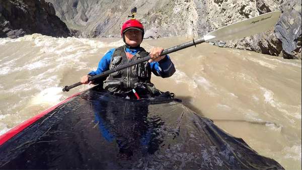
About 30 years ago a team of Chinese rafters tried to paddle down this section of the Yellow River but their boats sank and seven drowned. More recently a guy who calls himself 'Semit(e)' Shen Mite 闪米特 tackled it solo on a packraft and survived - but only just. I won't be taking my packraft.


Similarly there's a remote section north of Lanzhou that wends through canyons into Ningxia and there are no roads following the river from the bleak eroded hills that hem it in. I guess I'll just have to ride along the nearest rods that bypass these sections. 

I've broken the trip down into four sections of roughly 1000km each, each of which will take about a month [average daily cycling distance 30km). I'll be starting in May, and spending a month on each section, with the hope that I'll be coinciding with the moderate weather months of the north China and the Tibetan sections from June to August.


Section 1: I'll be starting from the Yellow River sea outlet in Shandong and travelling through industrial and semi-rural districts of Henan to the border with Shaanxi, via places like Taishan, Kaifeng and Luoyang. I'm starting in the lowlands so that I can get accustomed to cycle touring and acclimatised to altitude slowly.


Section 2 will leave behind the cradle of Chinese civilisation in Shandong and Henan, with the second month seeing me heading north through remote canyon territory along the Shanxi/Shaanxi border towards Inner Mongolia.

There may be side trips to places of interest such as Yan'an. Some stretches of the Yellow River in this section have no roads and I'll have to bypass these riverside sections ... should be at Baotou by end of June,  hopefully afyer the sandstorms and in time for mild summer temperatures.


Section 3 is a fairly bleak but mostly flat desert terrain of Inner Mongolia, turning back south towards Ningxia and Gansu. Again there is one section approaching Lanzhou where there are no roads following the river for about 100km, and I'll just have to go around it on the nearest main highway.

Section 4 of the Yellow River cycling trip will be the most difficult - ascending into the loess uplands of Gansu beyond Lanzhou and its Muslim population, passing massive dams and wilderness areas such as Kambala. Then I'll be going even higher into the ethnic Tibetan grasslands of Qinghai, where the Yellow River twists via marshlands and through massive unexplored canyons around Lajia. On this section I'll be bringing a tent and may have to camp on some parts of the route if I can't find Tibetan villages to host me.


The final goal will be to reach the source of the Yellow River near Gyaring Lake, Maduo County, 4200m altitude. Timing is crucial as this region is only bearably warm in June-August. I won't be going to the literal source of the Yellow River, which is a tiny trickle of water on the side of a hill about 200km from the nearest village. Firstly its impassable by bike, and secondly it has been put firmly off limits to tourists by local authorities to avoid damage to the fragile ecosystem.

 I'll be staying in hotels and guesthouses for most of the route so won't need to take much gear on my  conventional touring bike. I've just semi retired from work so I have the time and the 3-month (renewable) family reunion visa that will enable me to try this long term trip. 

I'll be departing Australia in late March to do a bit of preparation, planning and a possible recce trip before setting off in earnest in early May. 

Monday, January 13, 2025

Trip report: up the Nujiang, down the Mekong, on a folding bike

Just back from a two week trip in Yunnan, exploring sections of the Nujiang and Mekong rivers by bike. 

I picked up my Dahon Jetstream 20 inch wheel folding bike from where I'd left it in Kunming's Upland Hostel, and took the high-speed (300km/h) train to Baoshan. My route was north along the river to Gongshan, with stops at Baihualing (百花岭) birdwatching centre, Liuku (Lushui) and Gongshan. Then over the newly-built De-Gong highway to Deqen via Dimaluo, and then exploring the Mekong gorge southwards towards Cizhong.

There was no real goal to this trip other than to have a nice New Year break away from the Australian summer holiday crowds.


I travelled light, with just a simple 45L backpack strapped on the back of the bike - no camping equipment. I stayed in local hotels and guesthouses that I booked via WeChat (Weixin), which generally cost around 120-150 kuai a night.

The hardest bit of the trip was the first day from Baoshan to Baihualing, which involved quite a bit of up-and down with overall ascent into forested hills to Pupiaozhen, then a steep descent some 1500m to the Nujiang [and a police checkpoint, at Lujiang]. 


From the river I biked up the main highway to get to the small village of Gangdang (岗党) below Baihualing, where I hired a local driver to take me and my folded bike up the 1000m or so into the forested Gaoligong mountains to Baihualing. 


Birdwatchers will know this place well, the 'environmental tourism zone' of 百花岭生态旅游区 (Baihualing Shengtai Luyouqu) is well organised with many hides where twitchers with telephoto lenses can observe many rare Asian birds feeding at prepared food and watering holes set up by local farmers. I stayed a couple of nights at the posh Lingzhi guesthouse with an idyllic setting, just as an excuse to be somewhere different for New Year's Eve.


I tried a day of birdwatching in a hide, but after three hours I must admit I'd had enough, despite being a former member of the RSPB and the Young Ornithologists Club.  The forest trails I used to return to the guesthouse were nice enough, though. 


Baihualing Tip: if you come here, bring  most of your supplies: there is only one 'supermarket' in the village with limited stocks and it's a 2km hike up the road from the Lingzhi guesthouse.


Day 2 I biked up northwards on the highway along the placed Nujiang in beautiful winter sunshine.  Passed a few holiday resorts and this was definitely 'coffee country' judging by the number of places offering tasting. The traffic wasn't too heavy and for some reason many of the new roadside building are done in mock Thai/Burmese style. Had to negotiate a couple more police checkpoints before Liuku, at the places where the roads from Baoshan/Dali meet the Nujiang bridges.


Liuku was a pleasant stop - it seems to have an ideal climate and friendly people - as well as good infrastructure. I stayed at the Liushui Jiangzhi Panjin hotel which has a perfect location next to the bridge and river, and reasonable prices (190 kuai).


Day 3 I skipped the long 400km pedal up the Nujiang valley to Gongshan via Fugong because I've biked this before in the opposite direction, on a Brompton. For 150 kuai I shared a private van to Gongshan from outside Liuku's bus station. One of the advantages of a folding bike - chuck it in the back of a car and skip the boring/difficult bits!


I stayed at the Lavande Hotel in Gongshan, where I made a last minute decision to avoid the Dulong valley, which I already 'did' exactly one year ago, but on foot/hire car. Instead, I decided to try cycling up to Dimaluo to check out whether my old Tibetan host and trekking guide Aluo was still around. I'd previously hiked over the main range in a 3-day trek from Cizhong to stay at Aluo's lodge.


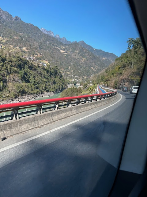
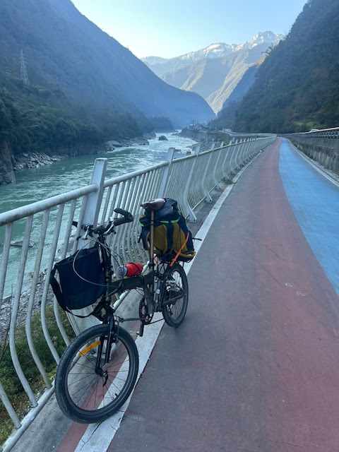
Day 4 was a pleasant surprise as I discovered there was a dedicated cycle path tacked on to the highway all the way north from Gongshan. I followed this empty track, marvelling at the riverside scenery. It was about 35km to Dimaluo (迪麻洛), which took me through many interesting small villages and riverside settlements. I saw no other bikes [or tourists] on the trail, which must have cost a fortune to build. 


Apart from a few places where it was blocked by parked cars, it was a great trail. At one point it separated from the highway and switched over to the other side of the Nujiang, which was even more impressive, scenery and vibe-wise.

Arriving at Pengdang bridge (捧当大桥) at lunchtime I had some great noodles from a roadside stall, then began the grind up the 8km of switchback road leading up to Dimaluo. The road was good and the gradient not too severe because this was the start [or end] of the Deqen-Gongshan Highway (Degong Gonglu, 德贡公路). A feat of engineering that links the Nujiang and Mekong (Lancang) river canyons by crossing the Hengduan mountains. 


Before the highway was built, travellers to Gongshan and Bingzhongluo had to drive 400km up the Nujiang valley from the only northerly access point at Liuku, and then double back to return. With Dimaluo only about 70km distant from the Lancang (Mekong) as the crow flies, it made sense to build a 'short cut' highway over the Peacock Mountain pass  (孔雀山垭口, Kǒngquè shān yākǒu) of 4500m. Until recently the only direct way over the mountains between the Mekong and the Nujiang was to hike over the 4000m+ Sila Pass, now known as the Selalaka (蛇拉腊卡垭口), as I describe in my blog from a decade ago.

But now the Nujiang-Mekong (De-Gong) trans-mountain highway has been completed and the road is now a modern tarmac and concerete dual-lane highway all the way, including a 1km tunnel that cuts through the final mountain ridge.


I found Aluo's lodge in the small village of Dimaluo, which is now the western entry point to the De-Gong highway. I first visited about 15 years ago, when Aluo hosted guests in his wooden cabin which acted as guesthouse and an informal trekking guide centre.


Now his guesthouse is a bit grander and more upmarket, but still Tibetan and Catholic in character, with a crucifix and yak butter tea in the  breakfast room. I was the only guest that night and shared dinner of hotpot chicken with his family. Over dinner Aluo said the highway had not brought as much tourist trade as he'd expected. The new Chinese breed of independent SUV 'self-guided' tourist tended to whizz through from Bingzhongluo en route for Deqen, without stopping overnight at Dimaluo. 


He also made an interesting point about the government being generous to local minority communities. By providing financial benefits that equalled 70% of their expected household income, these subsidies encouraged rural households to plant more tress and keep the environment clean. But conversely, this meant that they no longer had any incentive to plant and grow crops. He showed me a cabbage that he said was 'imported' from Baoshan area because local cabbages were in short supply and cost three times the price. 

Similar to a rant I heard from a Dulong farmer, Aluo said many poor rural kids were now getting good educations, with many going to university in major centres. However, on graduating they did not want to work in the fields or do manual work. This meant rural kids and communities were losing the traditional crop-growing and livestock rearing skills that had been passed down for generations. More kids should be sent to vocational schools, he argued.

Day 5: After a leisurely Tibetan breakfast of mantou, pickles and yak butter tea, I waited to be picked up by a driver organised by Aluo to take me over the De-Gong highway to Deqen. Before I left I managed to take a look at the local Catholic church, which in 2008 had been a simple but beautifully crafted wooden structure. Sadly this had been demolished in 2016 and replaced by a larger and more utilitarian  concrete structure. The previous church had been draughty, leaking, rat-infested and hard to maintain, the locals told me.

2025

2008

The drive over the Hengduan divide to Deqen was a white knuckle ride thanks to a maniac driver who seemed to accelerate rather than brake around the twisting, switchback road loops up in the forested highlands. And even with sunny clear weather there were patches of ice and snow along the higher stretches of the road.


So I was relieved when we made it through the summit tunnel and began the equally long and twisting descent to the Mekong, into territory that was more culturally Tibetan compared to the mixed Lisu/Naxi/Nu/Tibetan of the upper Nujiang.

After twisting down the long narrow gorge of Yongzhi (永支, aka Lonjdre, which Joseph Rock dramatically described as "a veritable corkscrew up a weird black chasm" into the depths of the canyon), we finally hit the Mekong river. In contrast to the green and fertile Nujiang, the upper Mekong is barren and brown-ish grey for much of its length. The only few patches of green were rice and maize terraces at river level.

The driver dropped me off in Deqen after a long haul back up from the river. I cycled 10km to Feilaisi along another new and unused section of separated cycle path. With the altitude now around 3300m, I had to go very slowly because I was affected by altitude sickness.


I booked into a slightly tacky roadside hotel at Feilaisi, which has now seen hotels and restaurants mushroom to meet capacity demands of huge crowds that come to see the sunrise breaking over the mountain. I was one of them and had selected this 'tacky' hotel because it had a grandstand view of the mountain, over the heads of the thronging masses of the observation deck.


The service at this Tibetan-run hotel was a bit take-it-or-leave-it, which was exactly the market situation given their monopoly on ringside seats for the sunrise. I was out of breath just climbing the three flights of stairs to my room, and almost overslept.

Day 6 saw me up before dawn, setting up my time-lapse iPhone camera in the window before turning to more routine matters such as making some coffee and packing my bag. Sunrise was at around 8am, and I managed to capture a nice transition from dark skies to golden and then bright white sunrays on Kawakarpo.


This was not planned to be my final day 'on the road' but it turned out to be. The original notion was to cycle down the huge descent to the Mekong, then continue south about 50km or so to reach the Catholic church at Cizhong - now a major tourist attraction. I've visited Cizhong at least twice previously and had no great desire to make a repeat visit. But I saw it as a convenient stopping off point for onward travel south towards Weixi.

As it turned out, I decided to call it a day after finding myself exhausted from the after-effects of altitude sickness later in the day.


But first I backtracked along the cycle path to an almost deserted observation deck, where I found a makeshift tent camp belonging to a Chinese touring cyclist. Shivering in his thermals as he emerged from his wigwam, the guy told me he was heading to Tibet to spend 'new year/spring festival' there. He reassured me that it was downhill almost all the way to Cizhong and wished me well on my trip in the opposite direction to him.

However, I found the steep descent to the Mekong was no freewheeling fun time. The 'short cut' rural road suggested by the Gaode Map app cycle route turned out to be an exhausting exercise in gripping the brake handles and trying not to let the bike run away. I must have worn out the brake pads as i had to keep adjusting them to maintain any stopping power.


I was glad after an hour when I finally reunited with the main highway just below Deqen, and the gradient was much less dramatic. This WAS freewheeling heaven, and also increasingly photographer's heaven too. The white triangular peak of Miyetzimu (緬茨姆) mountain peeped over the horizon and made an awesome backdrop to my ride.


It took me a couple of hours to 'cycle' down to the first village of Yunling (云岭), down through the rocky barren cliffs until I finally caught sight of the Mekong far below. It was a curious bright green/turquoise colour that could almost be nuclear pollution rather than glacier meltwater. Suffice to say this scenery that had me stopping to take snaps after turning each of the many corners of the cliff-hugging road.

I'd been along this route on a bus before and it had been frustrating seeing such epic views without being able to stop and photograph them. Now I could, and I did. This must surely be one of the most scenic highways in the world, and it's a mystery why the Chinese don't publicise it more.


However, I found the occasional level or slightly uphill sections of the road to be extremely tiring, like pedalling though treacle. By the time I cycled into Yunling, I decided I'd done enough pedalling and would spend the last four days of my holiday visiting family in Guilin rather than grinding out the kms along the Mekong. I found a roadside restaurant that did rice noodles and organised a van ride back up the hill to Deqen with the nice Tibetan lady who ran the place.


While waiting for my van ride in the space of about 20 minutes I was able to get on the WeChat app and organise almost all my travel and accomodation arrangements for the trip to Gulin: train tickets from Dali to Kunming and on to Gulin, and hotels in Dali and Kunming.

Once back in Deqen I was able to get the 3pm to Dali/Xiaguan, which arrived around 11pm - and that was the conclusion of my longer distance cycling trip for the holiday.

I did use the Dahon again in Guilin, but that was more for day trips to places such as the Ming princes' Mausoleum at Jingjiang Wangling (靖江王陵).


Gear details: for any would-be folding bike tourers, my kit was pretty simple.  I wore a Fjallraven Skogso jacket which is a cotton mix that is very breathable and windproof, but not very waterproof - showerproof at best. I prefer this to a hard shell, as it is much better ventilated and not sweaty when cycling. If it really rains I throw on a waterproof cycling poncho. I combined this with a merino long-sleeve thermal top that is warm when it'c cold and vice versa. The bike is a Dahon Jetstream P8 folder, which I modified with a 9-speed hub and smaller (39T) chainring to give me a bit more range and hill climbing capability. I found that a 45 litre backpack and a small (15L?) Decathlon hooked handlebar bag were enough to carry my basic gear. My two 'lessons learned' were to bring a wing mirror and some gloves next time. A neck scarf/bandana was essential for those cold morning starts too.

Friday, January 03, 2025

On the road in the Nujiang

 I’m currently in the Nujiang ( Gongshan) on a cycling tour with my Dahon Jetstream folding bike. I’ve come up from Baoshan via the birdwatching centre of Baihualing and the town of Liuku. Today I hope to revisit Dimaluo and Baihanluo, where I was last in 2008.