Sunday, November 10, 2024

Return to Muli monastery (木里大寺) after twenty years


If you’ve read this blog you’ll be aware that I first visited Muli monastery (Muli Dasi, 木里大寺) in 1994 on my first exploratory trip to try check out the travels of Joseph Rock. That solo trip was something of a landmark because it showed me that Rock’s maps were accurate and that the places he described were still there, although much changed since the glory days of the 1920s. 

When I saw it in the 1990s, Muli monastery was a spooky place. Just a couple of rebuilt temples and a handful of monks remained of the once thriving Tibetan Buddhist monastic complex on the side of a hill in the majestic canyon of the Litang river.


I subsequently made a couple of return trips, with the aim of exploring further beyond Muli to the Konkaling (Yading) mountains. Both attempts failed due to various factors: bad weather, a lack of accurate topographic maps and a breakdown in team cohesion between the other New Zealand tramping companions.


With the advent of the internet, I’ve been able to keep an occasional eye on developments in Muli from afar.  Over the last two decades I’ve seen reports of how the temple has been upgraded, with shiny new buildings constructed. I also read on Chinese website that the once isolated Muli valley had been opened up to development and tourism. 

When I visited there was only a poor quality dirt track road over the pass from Lugu Lake to the nearby village of Wachang, which itself was a collection of grim and utilitarian Soviet-era buildings. There was a better road down the valley to the town of new Muli (Bowa), which was open to trucks and buses. However, even this sealed road had some very dangerous sections that scared the life out of me.


So it has been interesting to revisit Muli for the first time in twenty years and see how it has changed. I went courtesy of Professor Zhu Dan of Sichuan University and his colleague Professor Wang Liang of Nantong University, both Rock-o-philes like myself.

This time the journey from Lugu Lake in a Landcruiser was relatively quick and easy, taking just three hours driving, not three days walking as per my first visit. The road over the Mt Gibboh Pass has now been sealed, and is good quality. En route we stopped in the same places I had rested at in 1994: Lijiasun, Renjom Gompa and Wujiao (more of these visits later).

The route itself was not much different from that I described in 1994 – a long looping track up the wooded valley to the pass over some limestone crags of Mt Gibboh. The only difference now was a sealed road and a couple of roadside viewing points – and toilets – for the sightseers. Because there were now more cars on the road. While in 1994 I had seen but one vehicle all day - a 4WD that got stuck fording a creek – this time there were cars passing every ten minutes or so: mostly independent tourists by the look of it. There was also a small settlement – Yangbude – near the pass which I hadn’t noticed before. The ‘Mt Gibboh’ pass itself was now titled Luopuluo Shan.

On our way we stopped at one of the many artificial water pools/ponds that have been created by the local government as a resource for fighting forest fires – of which there have been some terrible ones in the Muli area recently. And everywhere there are signs warning that no fires or smoking are allowed anywhere in the forest zone.

We stopped at the pass to take some photos but on the way in to Muli the weather at the top was foggy and damp, so we got no views. Descending to Wachang, we emerged from the cloud to see the sweeping green valley below us.

Arriving in Wachang (瓦厂) was a revelation – it was still a one street town, but the scruffy old buildings had been upgraded to modern multistorey apartments and a spanking new school. The scuzzy old concrete hotels had been replaced by neat Tibetan-style wooden guesthouses. There was even a Joseph Rock noodle restaurant.


I recognised some of the old buildings still standing from my first visit – the poky restaurant where I’d slaked my thirst after that marathon hike over the mountain was now a clothes shop. The post office was also still there – but the grotty post office hotel was – thankfully – long gone.

We checked in to the Kangsa Zhusu at the bottom end of town and had a wander up the main street. When I showed some of my old photos to a local woman she recognised one of the Tibetan  ‘hunters’ I’d taken a snap of up in the hills back in 1995, and she later brought him over to us to have a little reunion – we were both older and greyer than the original photo! He now helped run a shop in town and told me about his kids now going to college and settling down in the big city of Xichang.


That evening we had a great dinner with many dishes at the restaurant next to the Kangsa Hotel.

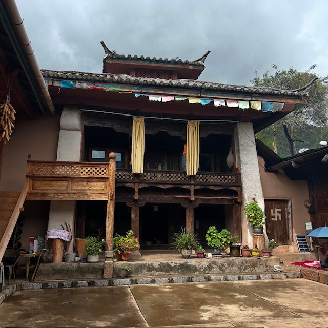
The following day – 27 September - we had a day out visiting the monastery. It was mild weather as we drove the 3km road round the hills to the monastery complex. It was barely recognisable from my previous visits, now comprising several grand temples, that had been rebuilt around 2015. The centrepiece was a building containing a replica of the Big Qiangba Buddha, 28 metres high and made from copper, coated with gold leaf.


I spent the day wandering around the monastery buildings, findings the original old temple now abandoned and used for storage. The old ruins of the 1920s monastery have been preserved, with protective walls and scaffolding placed around them.


During the day we were introduced to several current monks, who looked at my old photos of young adolescent monks from 1994 and recognised a few. They pointed to each one, saying where they had gone to – some to nearby monasteries, some further afield, to Lhasa, India or even Belgium. After snacking on walnuts and tea in the monk’s hall, several of the original monks who they’d tracked down were ushered in and we sat around chatting for a while. We even got to do a reunion photo in the same courtyard of the old temple.


Similarly, Zhu Dan was eager to do a then-and-now photo of one of Rock’s photos, taken with Mt Mitzuga’s crags as a backdrop. He located the likely spot, now overshadowed by the monk’s three-storey high accommodation block, and we recreated the group photo, even copying the same body gestures of Rock’s retinue.


I also walked off to the edge of the site to try find the place where I’d taken my original then-and-now photo of the side view of the old and new [destroyed] monastery complexes. It wasn’t easy to find – the old track had now been paved over with a car park, and the area had a sightseeing platform and wooden staircase. I think I found the right place, but you be the judge:


A local official and Buddhist adviser told us that the monastery was now the home of the 10th Living Buddha of Muli, Bianma Renqing, a local lad whose bio says that he studied at the Beijing Advanced Buddhist College.

We spent much of the day filming with the guys from Sichuan University and doing some interviews with various people on camera. I had to pose in various locations that I’d previously visited, and even ride my bike around for the cameras, followed by a drone.

So I was pretty exhausted by the time we drove back to Wachang – for another big dinner, this time at the Tibetan barbecue/hotpot restaurant at the top of town.

One last 1990s vs 2024 photos of Muli:


Monday, October 14, 2024

Return to Lijiasun (Lijiaju, 利家咀), 30 years later


If you read my account of my first trip to Muli, now more than 30 years ago, you will know that my first port of call once I 'walked off the map' was a small village in the hills north east of Yongning which Rock called Lijiasun. It was a couple of hours hiking from the hot springs near Yongning and back then it was a very primitive place of log cabins inhabited by rough-looking Mosuo, Naxi and Mongol people. No electricity or roads, and very few amenities such as running water. It reminded me me of the medieval village in Monty Python's Holy Grail - subsistence farmers literally living in mud.


I was to visit Lijiasun again in about 2004, when it was little changed, ie still very primitive.

So it was interesting to revisit Lijiasun (now known as Lijiaju 利家咀) a couple of weeks ago and find it transformed into a kind of Eco-Ethnic Holiday Village, now billed as "Lijiazu - the last Daba Matriarchal Heritage Village" tarted up and consisting of guesthouses and holiday homes, performance spaces, floral displays and with mobile phone towers powered by banks of solar panels.


What happened?

Well according to Chinese media, Lijiasun was recognised as a place of particular deprivation and isolation  about a decade ago, and became the target of modernisation and poverty alleviation efforts to develop Ecological businesses an install 4G broadband services etc. It has certainly made a big impact and transformed the village.

We drive there in about an hour from Yongning along a decent road, and parked up in the village 'square' next to a stupa, with a noticeboard now inundated with announcements and signposts. There was another tourist coach in the car park and a group were roaming around, photographing everything.

We met one of the village leaders, a livewire guy who calls himself 'Black Wolf' on his WeChat account, and who took us to find one of the older villagers who might recognise some of the people I photographed 30 years ago.  Uncle Du Ji  - a man in his fifties - lived in an ornate old wooden 'siheyuan' - a quadrangle courtyard house with an old prayer room at the centre. 


He invited us in to drink butter tea and eat walnuts, as I explained how I'd visited here before three decades ago. As I took out my phone to show him my photos, he waved it away and said "No need - I have them already". And to my astonishment he scrolled though his own phone's photo album to show me my own photos that he said he had downloaded many years ago from this blog site! At the time they were some of the few existing photos of people of that generation, he said.


"So you are the foreigner who took these pictures," he said, and proceeded to give me a rundown on who the people in the photos were - the young men staring sullenly into my camera lens, now an older businessman. The wretchedly poor people gathered round an open fire on the hillside - some now have died, bit others are still in the village, making a living in farming.

I spent a happy hour taking photographs and being shown around his magnificent dwelling house - now a holiday homestay - and the temple within. He had portraits on the wall of Genghis Khan (the Mongol ethnicity link comes from the leftovers of Khan's army venture into Yunnan a millenia ago) and groups of local people in traditional dress. I was also the subject of quite a few photos when the visiting tourists heard about my story - and wanted to get a picture with the 'old foreigner'.


Du Ji then guided us on our main mission for the day - to identify the location where a photo of Lijiasun was taken many decades ago. We thought it was a Joseph Rock photo, but a sharp eyed villager pointed out that a child in the photo was wearing more modern clothes, possibly from the 1980s onwards.

Our photo location quest took us on a hike up the hill behind the village, where we struggled to match the exact location because there were now new buildings and a lot more overgrowth of bushes and trees where it had once been a barren hillside.

It would have been nice to stay longer in Lijiasun, but we had to move on the get to Muli the same day - and that meant a long drive over the mountain pass.

Monday, October 07, 2024

Solving the 100-year old mystery of Joseph Rock's Mt Mitzuga (木仔耶) photo


 Just back from an excellent trip to Muli (木里), in the company of Professors Zhu Dan and Wang Liang from Chengdu and Nanchong, respectively.

The highlight of the trip was finding the location of the photo taken by Joseph Rock of an alpine tarn just below the crags of Mt Mitzuga (Chinese: 木仔耶, Muziye). In the original photo there are two figures on horseback in the foreground. We managed to find this spot (and recreate the photo, the place is unchanged) after many hours of terrible driving on a rough 4WD track from Wachang, including two punctured tyres.

Other highlights of the trip were returning to places I had visited 30 years ago on my trek from Lugu Lake to Muli - including Yongning's Zhamei Si monastery, the village of Lijiasun, the Renjom Gompa temple, Wujiao and of course Wachang town just near the monastery. Amazingly, at these places I was able to meet people who had been there 20-30 years ago and remembered me 'the foreigner' from those times. I will write about this later.

For this post, though, I will describe how we got to the summit plateau of Mt Mitzuga, which is at a height of between 4300 and 4700 metres.

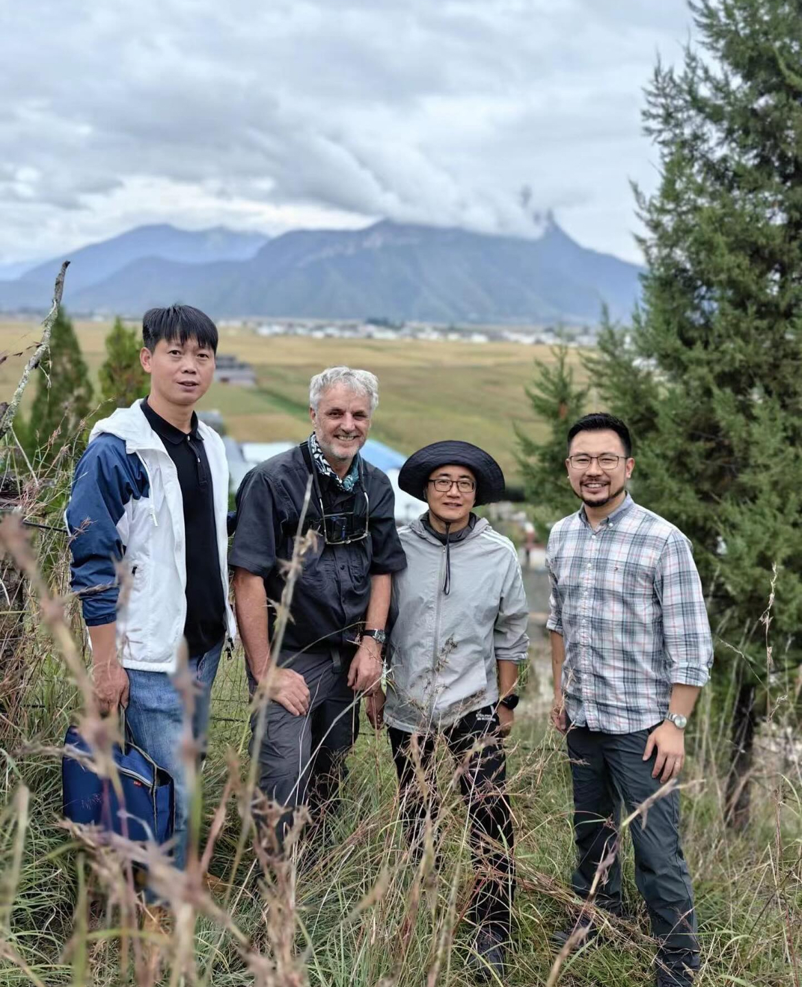
Driver Jiang Rong, me, Prof Wang, Prof Zhu Dan,

(Pic: Driver Jiang Rong, me, Prof Wang, Prof Zhu Dan)

The credit goes to Professor Zhu Dan of the Chinese Academy of Sciences Chengdu Botanical Research Institute. It was he who kindly invited me along on the trip that he organised, with three 4WD jeeps, a film crew and two local guides. I had always wondered about the location of that photograph, and was curious as to how Rock got to the summit crags of Mt Mitzuga from Muli. 
 
If you have read this blog you will know about our 1996 trip to Muli with some kiwi trekkers, in which we tried to cross from Muli to the Shuiluo river valley via Mt Mitzuga. That trip failed because we became snowbound over night and lost our way, bashing through knee deep snow and thick pine forests, unsure of where we were and making very slow progress over fallen trees. 


We never saw the summit crags of Mitzuga because the weather brought low cloud and fog. We eventually 'crashed out' by following a logging road to Baiyangping and hitching a ride on a truck back to Muli.

(The green line shows the approximate route we took from Wachang to Mitzuga. The red line is the sealed highway that now runs to Muli monastery from Yongning (Lugu Lake) and Wujiao).

This time, Zhu Dan was better prepared, but we still hit a few snags. I'd seen on Google Earth that there appear to be a few tracks criss-crossing the summit plateau of Mitzuga, but it's hard to follow them and many seem to peter out into nowhere. But with two local guides on board, we set off from Wachang on an overcast September day to try access the summit tracks. In hindsight we should have tackled the approach from the western side, via the new highway that runs via Guzheng, Maoniuping and Baiyangping to the Shuiluo valley. 


Instead, we took the advice of our guides, who thought our priority was to see the best of Mt Mitzuga scenery rather than one specific part of the summit plateau. Their route took us back over the road towards Wujiao (now sealed), over the pass and to a very well hidden turnoff at a corner of a zig-zag above Wujiao,  near a collection of huts. The 'road' was not even a dirt track, but a faint trail riven by ruts, boggy puddles and eroded sides. Even our Toyota Landcruiser (Prado) had difficulty navigating the bumps and tight corners. 
 
We probably started at around 10am on the track, which initially consisted of a switch back mud track up in the fog to a small alpine lake. We stopped their for a route planning discussion, at which Zhu Dan realised the guides had brought us the 'long way' and insisted we head back to wards the priority area rather than stopping for sightseeing.


Without giving a blow-by-blow account of the road trip, suffice to says it was extremely challenging and also supremely beautiful. Credit must go to our skilful driver, Jiang Rong, from Chengdu, who was able to get the jeep through some appalling track conditions while making it look easy - and keeping us entertained with his witty conversation in the process.


In some sections it was a reasonable gravel track, in other places it deteriorated into just a couple of faint lines in the grass or mud. We crossed over open moorland and scrub, past huge limestone crags, and sometimes plunged back into thick spruce or larch forest.

 Occasionally we saw log cabins or small farm settlements, but nobody appeared to be living in them.


A couple of hours in, at a bleak pass strewn with prayer flags we had to stop to change tyres on two of the jeeps, which had suffered punctures. Is this a world record for a tyre change at an altitude of 4500m? 

As we milled around I quickly regretted not bringing my fleece - the wind was bitingly cold, but thankfully Zhu Dan had a spare down jacket that he lent me. After about 40 minutes delay we continued, following the track that seemed to go down one side of a canyon and then cross over and come up the other side. 

On a few occasions the road forked and we were reliant on the guides to tell us which direction to pick. They also helped when we found the road blocked by log gates, which they were able to open [dissemble] and close again quickly.


Finally, in the late afternoon around 4pm we drove uphill to a line of crags that looked similar to the ones in Rock's photo. The guides told us this was the place, and we excitedly piled out of the jeeps to take a closer look. We had to hike uphill for about ten or fifteen minutes to reach a suitable viewing spot, and then it was clear that this WAS the spot - these were the crags that appeared in Rock's photo. 


But the foreground looked different - there was no small tarn or lake evident. At first we assumed that it had dried up, perhaps because it was seasonal and required some rainfall to fill it. But Zhu Dan and his team kept on moving up the hill for a few more minutes and finally they came across the small round patch of water exactly as it looked in Rock's photo. On close scrutiny we could see that the rocks around the water were exactly the same as the ones in Rock's photo - and even a small rock protruding from the water in the middle of the pond was still just as shown in Rock's photo.

To say I was thrilled was an understatement. It felt uncanny to be in exactly the same spot as where Rock had taken to photo 100 years ago, especially as the scene was completely unchanged. I must admit there is some uncertainty over the date of the original photo. Rock first visited Muli in 1924, and may have taken the photo in that year. But he also revisited Muli in 1928 on his way to Konkaling (Yading), during which trip he crossed the Mitzuga twice, so the photo may only be 96 years old!


We milled around the area, of course taking many photos and videos, and also conducting some interviews for the TV crew that Zhu Dan had invited along to record the journey. I did my interview in a hailstorm!

I could have spent a whole day up there, exploring, but agonisingly after such as long trip, it was late in the days and we had to depart after about half an hour so that we could get back to Muli during daylight. I wouldn't want to try navigate those mountain tracks in the dark. I really didn't want to leave, but time was against us - it really felt like a magical place. The guides later told us that this was a sacred spot for the Muli people - they believed that if the lake and crags were disturbed by human sounds, it would trigger hail and snow storms - just as we had experienced!


So reluctantly we set off, to complete our traverse of the summit plateau. The ordeal wasn't over yet - it was no easy downhill retreat. There were still many miles of poor track, uphill and downhill sections and more gates to open and close. We still didn't encounter a single soul, until at dusk we finally reached the 'main highway', the sealed road that now crosses the watershed from Muli to the Shuiluo valley.

We made it just in time: it was dark by the time we started the long zig-zag switchback road back down in to the Muli valley. Phones started pinging and buzzing - we had a signal again after being off the grid all day.

Suffice to say we were in a celebratory mood by the time we got back to Wachang - justification for a big meal with plenty of baijiu and toasts.


Saturday, September 14, 2024

Going back to Muli


 Next week I will be going back to Muli, revisiting my first ever trip in the footsteps of Joseph Rock 30 years ago, when I walked from Yonging (Lugu Lake) to Muli monastery. 

In 1993 I was walking blind 'off the map' because there was no internet or Google to tell me whether Rock's hand drawn maps were still valid. Nowadays of course we can look at Google Earth whose satellite imagery has enough resolution to  show details of cars parked at the now opulently renovated Muli monastery.

 The Naxi/Mosuo villages Joseph Rock mentioned on his journey - Lijiasun/Wujiao etc - are still there, and this time I will be driving rather than walking through them. I'll be travelling with a friend  - and fellow Rock enthusiast - who is an accomplished botanist with the Chinese Academy of Science. He tells me that there is now the possibility of visiting the crags of Mt Mitzuga, the mountain that stands over Muli monastery. 

I am really looking forward to that. Afterwards, I hope to do a bit of hiking and camping from Muli towards the three peaks of Yading, which Rock called 'Konka Risumgongba'.

If you want to see the most up to date images of Mulki and surroundings, try the Copernicus satellite

On this, I can see there are now some trails and dirt roads around Mt Mitzuga. The Copernicus maps are not as high resolution as Google Earth, but they are updated every week, so are much more relevant for trip planning.


Monday, July 29, 2024

Wilderness hiking and camping now banned in Sichuan (and elsewhere?)


This blog describes the camping and hiking trips I made to off-the-beaten track parts of Sichuan and Yunnan from the 1990s to the 2010s. It was an era when it was possible to simply take a bus to a remote town such as Jiulong or Litang and have the freedom to set off on a hike through the forests and mountains, seeking help with food and shelter from locals along the way. While there might have been rules against this, they were seldom if ever enforced.

But according to a 2023 notice I just found on the Sichuan government website, off-the-beaten travel outside of designated formal tourist areas now seems to be forbidden.

The proclamation, entitled "Strengthening the Management of Tourism Activities in Undeveloped and Open Areas" states that tourists (and tour guides) are to "strictly abide by laws and regulations and regulations of relevant management agencies, and not to enter nature reserves, ecological red line areas, water sources, flood rivers, water conservancy projects under construction, state-owned forest farms, forest areas, grassland fire prevention areas and other areas where tourist activities have not been carried out without authorization."

The notice also warns media and social media sites not to promote "wild excursions" and also to delete any content that is posted about travel in "undeveloped areas".

For local residents in wilderness areas, the notice states that they should not promote travel to undeveloped areas nor set up private scenic spots, engage in commercial activities for tourists [including retail and catering for them] or guide people within wilderness areas, unless authorised by tourism authorities. Local people are required to take the initiative to identify and challenge any outsiders they see entering wilderness areas and to "patiently explain and persuade them to return."

Local authorities are required to "update the scope and management subjects of areas where tourists are strictly prohibited from entering, and adopt normal inspections and investigations, set up signs at the entrance of the area, and issue announcements through the media to remind people of the security risks and legal responsibilities that may arise from unauthorized entry, and promptly persuade them to leave. For those who enter in violation of the law, if they do not listen to dissuasion, they shall coordinate the public security organs to take compulsory evacuation measures when necessary."

I can well imagine similar bans being enacted in provinces with wilderness areas such as Yunnan, Qinghai and Gansu.

Tuesday, July 02, 2024

Choni 卓尼 update

 I have just updated the Choni chapter to reflect a recent discovery that Rock was concealing a major feature of the place - the presence of Christian missionaries and hundreds of converts. 

In his article about Choni, Rock portrayed the small town in Gansu as a remote Tibetan princely jurisdiction with a strange and unique Buddhist character, untouched by the outside world.

However, this article describes how Scots protestant missionary William Christie lived in Choni (Zhuoni, 卓尼)  for two decades from 1904 to 1924,  departing just months before Rock arrived. Christie converted hundreds of Choni Tibetans to Christianity and even won the favour of the local prince, if not converting him. 

Christie turned an abandoned Tibetan monastery into a mission station in nearby Lintan, and the locals are still practising Christians to this day. And yet Rock makes no mention of this, though he must have been aware, having lived in Choni for almost a year. Perhaps he didn't want to spoil the image of himself as a pioneer explorer.

And maybe the presence of a Christian enclave is the reason why Choni was deemed sensitive and 'closed' by the local PSB when I visited  - and was deported - a decade ago.


Monday, June 24, 2024

You too can follow the roads once travelled by Joseph Rock


Just a quick update for the Joseph Rock aficianados. Someone with the handle of @chinadrivingtours (link) has uploaded hours of Youtube footage of real time driving in the Tibetan borderlands of Yunnan and Sichuan [and many other parts of the provinces]. 

So if you like looking at a lot of tarmac and the occasional bit of dirt road, every single metre of the road from Lugu Lake to Yading is available to view in 22 episodes. Might be useful if you're planning a bike trip and want to see the road conditions.  

Looks like they did a big loop - Dali to the Nujiang then up to Bingzhongluo, then to Deqin and around to Zhongdian ('Shangri La' ) and Lijiang. Plus there's bit of Meili Xueshan, Litang, Baoshan, Tengchong and much more.

Sunday, May 26, 2024

My trip to Xinjiang: Part One - Kanas Lake


 Not Joseph Rock related, but I have just returned from an interesting trip to Xinjiang. It was a fairly random, last minute spur of the moment decision to go there, propelled by insanely cheap airfares currently being offered on Trip.com - A$500 return from Sydney to Urumqi via Zhengzhou, on Tianjin Airlines.

My main goal was to visit the north of the province, to see the scenery around Kanas Lake on China's border with Kazakhstan, Russia and Mongolia. I managed this quite easily with an overnight train ride to Beitun from Urumqi, through scrub-covered, arid plains, which reminded me of the Australian outback. 

From the scrappy town of Beitun I took a shared taxi costing Y150 over more 'desert' and then into green hills to the tourist hub of Jiadengyu. This is situated 30km from the lake and has something of a ski village vibe and the buildings have a European styling. This is where most visitors stay, because the hotels are affordable and there's a shuttle bus that operates at regular intervals to take you to the Lake Kanas  park entrance. Entry is about Y230, which includes the bus fare, and you get half price admission if you visit the next day.


The scenery around Kanas Lake was magnificent, explaining why it is such a popular attraction and feature of so many photo galleries. The rolling green hills and birch forests make you think you might be in Alaska or Scandinavia. The local people are mostly Khazak ethnicity and they practice dairy farming.

This was just a recce visit, so I did the main tourists things - such as taking the shuttle bus up to the Guanyutai ride walk, where a stroll up the hill on a boardwalk takes you to a pavilion with epic views of the lake.  Most Chinese visitors on a day visit do the 10 minute bus/walk trip down to the boat wharf and take photos of the amazingly clear waters with the snow capped mountains as a backdrop. During the summer months its possible to take a boat ride on the lake, but in May the lake was still partially covered with ice, so the boats weren't running.

You can easily escape the crowds by walking off the marked tracks and just follow the edge of the lake. There are some signs warning about this being a 'beast infested area' [pictures of bears, wolves], but I didn't encounter any on my hour-long walk beside the lake. In fact I didn't encounter a single other person - it was very quiet and solitary - The Hills Are Live with the Sound of ... not much.


I followed this up with an equally pleasant 3.5km walk back from the boat wharf along the boardwalk trail that follows the Kanas river back to the bus depot, via a quaint wooden bridge. Again, hardly anyone about once you leave the tourist hub.

On my second day I took another bus to the border village of Baihaba, where you can peer over the barbed wire fence into the hills of Kazakhstan. The guidebooks say this area is closed to foreigners, but I had no problems getting the necessary permit from the police office just next to the bus ticket office at the Kanas Lake tourism centre. It's a pleasant trip through rolling hills and forests, and to be honest there isn't much to do in the village, which has just a couple of shops and restaurants. You can stroll among all the log cabin style buildings down to the border fence, and try not to attract the attention of the guards in the watch tower behind you. The border is very heavily sealed off by fences and under surveillance, so don't think about wandering over to have a look in Khazakhstan!


The shuttle bus ride back to Jiadengyu is a scenic trip in itself, and takes about 40 minutes. At the tourist village there is a 'food court' outdoor plaza where you can try many variations on the local specialty of barbecued meat. This is dairy country so there is plenty of beef and yoghurt on offer.


I only had a few days at Kanas Lake but I would definitely consider coming back to do some camping, cycling and packrafting. While there are many Chinese tourists, they tend to stick to the official coach route itineraries. I didn't see any independent travellers or foreign tourists during my visit. There were also no police or security restrictions or hassles, which I had been expecting in Xinjiang - these were more obvoius when I went down south to Kashgar [see next post].