I sadly have to report that Joseph Rock and his legacy appear to have fallen into disfavour with authorities in China. His former residence near Lijiang that had been turned into a small museum has been closed down, and his name in Chinese, 洛克 'Luoke', has now become effectively become censored. Online articles that highlighted Rock's achievements in plant collecting and Naxi ethnography have been taken down, and his name has been removed from local features such as the 'Rock Road' to Zhagana in southern Gansu, one of the wilderness areas 'discovered' by Rock in the 1920s.
What does it all mean?
Perhaps we need to go back a decade or two, when local authorities in southwest China started to develop their tourism industries. The effusive articles published in National Geographic magazines of the 1920s by Rock describing areas such as Yading and Kawakarpo (Meili Xueshan) were ready-made free publicity material for local governments in the areas of Daocheng, Sichuan and in Diqing, Yunnan.
Local authorities also seized on Rock's amazing portrait photographs of local minority people and his accomplished landscape photographs of the incredible mountain scenery and colourful monasteries. His stories and images epitomised the lost mountain world of Shangri La, which was in part inspired by Rock's articles.
The concept of Shangri La came from writer James Hilton's 1933 novel
Lost Horizon, and subsequent 1937 movie by Frank Capra. Several scholars and writers have noted the obvious parallels in Hilton's book and passages from Rock's widely-read articles that were published just a couple of years before Hilton put pen to paper.
The Shangri La 'brand' was so strong for tourism that it was actually taken by not one but TWO local towns in southwest China. The ethnic Tibetan town of Zhongdian (Gyalthang in Tibetan) in northwest Yunnan officially renamed itself as Shangri La in 2001. Confusingly, the village of Riwa (日瓦乡) at the entrance to Yading National Park in Sichuan also renamed itself as Shangri La in 2009.

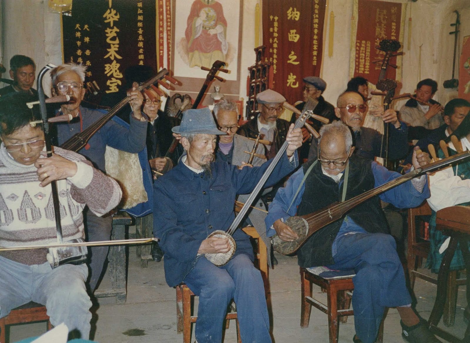
In Lijiang, local authorities preserved the former house of Joseph Rock, located in what was once the quiet Naxi village of Nguluko (Yuhu) beyond the city limits on the road to Jade Dragon mountain. It was a modest stone and wood dwelling, a few rooms arranged around a courtyard, similar to most family houses in the area. For many years the residence housed a small museum displaying a few of Rock's personal items such as his plant collecting equipment and items of clothing. One room was recreated as his study, complete with old items of furniture such as his chairs and desk. It was a simple place, he did not live in luxury: Rock had been something of a recluse and wanted little more than a quiet place where he could devote himself to the study and documenting of local plants and flowers, and later to his writing about Naxi culture.

As Rock's articles about his travels were translated into Chinese, they were taken up by the growing number of Chinese trekkers and car tourers who used them from 2010 onwards as a basis for travelling 'off the beaten track'. The hiking route to Yading from Lugu Lake via Muli monastery was dubbed the 'Rock Line' by Chinese trekkers, and the name was adopted by local villages who put up signposts as they discovered the economic benefits of providing food, lodging and guiding services to passing travellers.
Rock's name was then purloined by an increasing number of local businesses: hotels, shops, restaurants, who wanted to be part of the 'hot' new travel network. And in typical Chinese fashion, there were many copycats in other districts who wanted to jump on the lucrative Rock travel bandwagon. Even in far distant Gansu province, local authorities named a new road to the exotic rocky mountain crags of Zhagana as the 'Rock Road', in an effort to attract the growing number of self driving tourists.
Joseph Rock's travels and his stories also became the basis of a number of travel articles and photo features published online by local governments. Just as tourism operators in the UK highlight their local links to Harry Potter and Wainwright's fell walks, the tourism departments of places like Yading, Gongga Shan and Choni reproduced Rock's articles and photos to showcase the attractions of their local sites and minority culture.
So far, so good. But by 2024 there appeared to be a creeping pushback by some regional authorities against the use of Rock's name and stories for promotional purposes. I heard stories from Chinese friends of articles about Rock being taken offline, and of books and exhibitions relating to Rock being postponed or cancelled. A small group of Chinese academics and amateur scholars who studied Rock's works found that they had to tone down their online chat group on the social media outlet Weibo. They pre-emptively removed the two characters 洛克 representing the name of "Joseph Rock" from the title of their online circle group.
When discussing Rock's work on Chinese language forums, it was noticeable that some netizens began to question why there was so much interest in a foreign resident of China. The group was accused of 'foreigner worship'. Why, they were asked, did the group not take an interest in the overlooked achievements of Chinese counterparts working in fields of plant collecting, ethnography and photography?
I last visited the Joseph Rock residence near Lijiang in late 2024. By that time the once quiet and run-down farming village had become a tourism hotspot. The streets had been upgraded and gentrified so that they resembled those of tourism towns such as Dali and Yangshuo. Baisha, the nearest local town, was now full of cafes, restaurants, shops selling trinkets and had many boutique Naxi-style guesthouses. The streets thronged with visitors doing day tours from Lijiang, many riding the ubiquitous electric scooters and dressed up in items of 'Naxi' rural clothing.
I can only imagine what the studious and solitude-loving Joseph Rock would have made of the carnival atmosphere of his former home base. His former house was still open as a museum, and the displays had been extended and were presented in a more professional manner. The residence appeared to be well maintained and in good condition structurally. Nevertheless, the property saw only a handful of visitors when I was there.
Back in Lijiang Old Town I found there was also a Joseph Rock exhibition being hosted in one of the houses tucked down a back alley. It was a small and austere display explaining his works and his links to some of the other plant collectors and ethnographers of the Naxi and Dongba culture.
So in 2026 I am surprised and disappointed to hear that both of these facilities have been closed down on the orders of local authorities. There has been no official explanation as to why these actions have been taken. There have been a handful of posts and reviews on social media sites such as Amap and WeChat, in which Chinese visitors have expressed surprise and frustration at finding the Rock museums to have closed. Some reported in 2025 that the buildings of Rock's residence were still standing and just the signs had been removed and the doors locked.
But more recent posts in 2026 have expressed concern that the actual buildings have been demolished, and photos posted showing at least part of the property has been levelled. There is confusion in the comments about why this is being done, with some claiming that the closure is temporary and that refurbishment of the old buildings was necessary.
 |
| The Rock residence 'before' |
When I posted this news on Xiaohongshu (Red Note), with an image suggesting Rock had been 'cancelled', there was a furious response from many Chinese netizens. My initial post questioned whether the Rock museum had been permanently closed. The responses were divided between those who confirmed it, and others who angrily refuted this or sought to justify it as a 'temporary' refurbishment. Several told me it was none of my business and that I had an arrogant attitude, and did not understand China's way of doing things. Others noted that Rock's name had been removed from other places, such as the 'Rock Road' in Gansu now being renamed as the 'Jiangan Route'.
 |
| The Rock residence 'after' rectification |
When I posted up a follow up lament about promotion of Rock's legacy being banned in China, there was an even greater negative reaction. Many netizens declared that Rock had been an American spy, or that he had come to China to plunder its natural resources and cultural artefacts, in a manner similar to the Silk Road 'tomb raiders' such as Aurel Stein. Some said that it was China's prerogative if they did not want to highlight the activities of foreigners in Chinese history. Some comments were just direct abuse, calling me 'white trash' and such. Reassuringly there were at least a few comments saying that the hysterical anti-foreign accusations were similar to those of the mobs of Red Guards during the Cultural Revolution.
I will leave it there for now to see what happens. I am no blind hero worshipper when it comes to Joseph Rock. I can see he was a complex, flawed individual and that some of his attitudes and behaviour would now be classed as problematic and unacceptable. He lived in China at a time when foreigners enjoyed significant privilege and unfair advantages. He was well funded and enjoyed taking some western luxuries such as a personal chef and a portable bath when he went into the field for his extended expeditions. He expressed racist and prejudiced views about Asians that were normal for the period. And yet at the same time he was not a bigot nor an exploiter of his employees or indifferent to their troubles. He expressed affection and gratitude towards his Naxi staff and was renowned for offering medical care to the local villagers he met.
Rock was an unusually obsessive and reclusive man. In modern parlance we might say he was somewhere 'on the spectrum'. He was fixated on the collection, documentation and study of plants, flowers and trees. He shunned human company and had no interest in socialising with either locals or other westerners, unlike his Lijiang fellow expat Patrick Goullart.
Perhaps it was his German-Austrian thoroughness that drove his systematic recording and preservation of thousands of specimens. And conversely perhaps it was his newly-adopted American persona that drove him to dramatise and publicise his travels in print, and to negotiate the shrewd financial deals that brought him a good income from sales of seeds and also generous travel sponsorship grants from various official bodies.
He should be celebrated for being a polymath. An expert botanist, scholar and plant collector who was not averse to going out into the field for months on end to do his work away from civilisation. He later switched his academic and practical talents from plants to ethnic minorities, with his epic work documenting the Naxi and Dongba language and customs. He was an excellent photographer with an eye for composition of both personal portraits and wide landscapes and buildings. He was also a mapmaker, a linguist, a writer of academic textbooks and travel articles, an explorer and organiser of expeditions, and a teacher and mentor.
 |
| Rock's house and museum before closure |
When judging Rock, he should be seen in the context of his time and compared alongside his contemporaries in China in the early 20th century. He was contemptuous of many western 'Holy Roller' missionaries he encountered living detached from their Chinese 'flocks' in remote mission stations. He was quite unlike the acquisitive western merchants and rent-seeking officials who flocked to the western enclaves of Shanghai and Hong Kong. He was not like the oddball westerners attracted to the 'mystical Orient' nor the mercenary and political types who ingratiated themselves with the warlords. He was conservative by nature but not overtly political, and had little time for either the liberal Edgar Snow-type idealists and their sympathy for communist revolutionaries, nor the panda-hunting Kermit Roosevelt foreign policy 'hawks' who saw China as an exotic safari park and a potential market for American businesses.
Rock enjoyed the privileges of being a white foreigner in China at a time when the country was subjugated and hemmed in by foreign powers. There were foreign-run enclaves in Shanghai and a concept of exterritoriality that endowed de facto legal immunity to westerners living in China. Manchuria and ports in the north east were occupied by Japan, while Britain held Hong Kong and the French controlled Indo-China across the border from Yunnan.
By the standards of the day, Rock was a benign, eccentric scholarly figure. He did not seek to occupy, evangelise, politicise or plunder, nor enrich himself. All he wanted was to be left alone to pursue his plant hunting and writing. While he liked to live in grand style in the field, when he returned home he lived a simple life in a modest house with just the basic essentials needed to carry out his work.
It's odd therefore to see Rock abhorred by authorities in a China that supposesdly reveres scholars and respects those who live modestly. But in Xi Jinping's China there is no escape from the rise of ethno-nationalism that has blighted the USA, Europe and Australia. It looks like Rock's legacy has become the victim of the same narrow-minded nationalistic 'my country first' populism that is now being spread by social media across the world.


.png)


.png)


