
Tuesday, March 20, 2018

Monday, March 19, 2018
Some of my favourite photos from the Nujiang Christmas cycle ride ...
All taken with my trusty old Leica M2 and a 50mm Summicron lens.

This is the octagon building at Zhiziluo - a weird retro mountain town near Laomudeng. This forgotten village used to be the capital of the country, and it was known as Bijiang. The place fell into decrepitude after 1974 when the country admin function was moved down to the riverside at Luhshui/Liuku about 120km south.
Zhiziluo is now a relic of time's past, with a slight unreconstructed industrial/Communist feel to it. The people are Nu and Christian. This one street town is just 5km hike up a good road from the famous church at Laomudeng. One of the villagers will usually give you a lift up here -'re quite friendly.

Gongshan. What can I say? It looks so scenic from a distance, but close up it is has the usual Chinese shoddiness and pollution. This is taken from the 'beach' looking northwest. Over the hills to the Dulong valley and Burma. The memorial stands next to a tourist area but there are no tourists. The riverside area has million dollar views but no million dollars.

Gongshan again. This time taken from the top of the hill looking south, towards the river area where I took the photo above. You get a bit puffed out walking back up this hill!

This is the octagon building at Zhiziluo - a weird retro mountain town near Laomudeng. This forgotten village used to be the capital of the country, and it was known as Bijiang. The place fell into decrepitude after 1974 when the country admin function was moved down to the riverside at Luhshui/Liuku about 120km south.
Zhiziluo is now a relic of time's past, with a slight unreconstructed industrial/Communist feel to it. The people are Nu and Christian. This one street town is just 5km hike up a good road from the famous church at Laomudeng. One of the villagers will usually give you a lift up here -'re quite friendly.

Gongshan. What can I say? It looks so scenic from a distance, but close up it is has the usual Chinese shoddiness and pollution. This is taken from the 'beach' looking northwest. Over the hills to the Dulong valley and Burma. The memorial stands next to a tourist area but there are no tourists. The riverside area has million dollar views but no million dollars.

Gongshan again. This time taken from the top of the hill looking south, towards the river area where I took the photo above. You get a bit puffed out walking back up this hill!
More photos from the Nujiang bike ride at Christmas
Missing it already!

This one is taken look north from the outskirts of Gongshan. I've cheated a bit by photoshopping out some ugly powerlines running across the middle of the picture. Taken with my Leica M4 and a Summic50mm lens.

This one is taken look north from the outskirts of Gongshan. I've cheated a bit by photoshopping out some ugly powerlines running across the middle of the picture. Taken with my Leica M4 and a Summic50mm lens.
Sunday, February 04, 2018
Wednesday, January 31, 2018
My Nujiang cycling trip blog
Rather than re-post all my blog entries about the 2 week trip I will direct you to the original account at Crazy Guy on a Bike site.


Monday, January 22, 2018
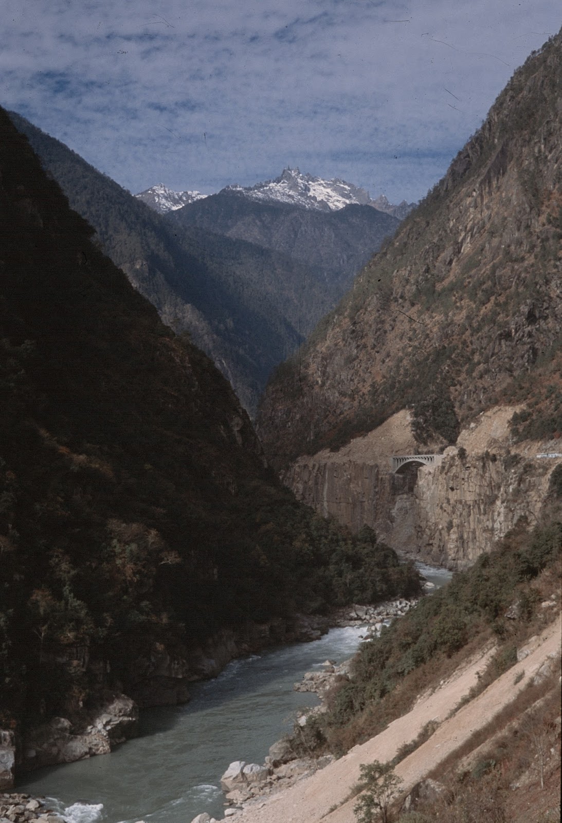
Some film camera photos from the Nujiang
I took my Leica M2 with me at Christmas and took a few photos with the 50mm Summicron and a 28mm Canon lens.


Thursday, January 11, 2018
A wonderful trip to the Nujiang - and Laomudeng (老姆登)

Just spent a marvellous 10 days cycling from the Tibet border north of Bingzhongluo to Liuku - about 300 km. Not ideal conditions for a small for a small folding bike - the 228 highway is being upgraded to make access better for tourists. But the scenery and the people were both fantastic. Going by bike allows you to see & experience so much more than being confined on a bone-rattling bus. The highlight for me was 'discovering' the mountain top village of Laomudeng, neat Fugong. A beautiful Christian church set up by the local Nu people. Spent New Year there. Bliss.

Monday, December 04, 2017
The Christmas itinerary ... cycling from Tibet to Burma
Due to a recent injury I'm not able to hike much at the moment, but can still ride a bike. So for Christmas I'm planning a lazy-ish ride down the Salween valley from the Tibet border to Burma.
It's a bit unadventurous of me as I've 'done' this area a lot in the past (as you can see from my previous posts). But given my current financial situation and gammy knee it's all I can manage right now. Departing 20 December - travelling solo and back to basics - no camping, just banking on finding guesthouses en route.
Hoping the weather is as mild as it was when I last visited 10 years ago. And I hope the Lisu/Tibetan Christians are still as welcoming when they celebrate Christmas ...

It's a bit unadventurous of me as I've 'done' this area a lot in the past (as you can see from my previous posts). But given my current financial situation and gammy knee it's all I can manage right now. Departing 20 December - travelling solo and back to basics - no camping, just banking on finding guesthouses en route.
Hoping the weather is as mild as it was when I last visited 10 years ago. And I hope the Lisu/Tibetan Christians are still as welcoming when they celebrate Christmas ...

Tuesday, September 12, 2017
The long awaited Deqin-Gongshan road (Lancang-Nujiang, 德贡公路)

UPDATE: Since writing this article I've come across an announcement that the road will officially open on December 30 2017 - so I assume it will be an all weather route!
On my last trip to Deqin in Yunnan in October 2016, I made a side trip down the Mekong (Lancang) to try check out the new road crossing the mountains from the Mekong to the Nujiang valley. This road has been under construction for about five years. It is being built as a short cut alternative to the only other way in to the Nujiang valley, via the Dali-Liuku route, which means a 1000km drive from places such as Deqin and Zhongdian.
The rough highway shows up on some maps and on Google Earth as linking the start of the Kawakarpo trek - at Yongzhi and Chalitong - crossing the Biluoshan mountain range and eventually descending to the Nujiang via Dimaluo. The road looks completed on the 2015 Google Earth images, but when I arrived in Chaliding in October 2016 I found that none of the Tibetans there willing to take me over by motorbike. Even in the dry and relatively mild autumn season they said the road was impassable - blocked by rocks and deep mud. Obviously still not finished. There were no buses or any other vehicles crossing between the two canyons, though some road construction trucks were occasionally going up that way (but they wouldn't take me).

I've been keeping an eye out online to see if there have been any developments, but little has appeared until now. If you search for the term 德贡公路 (De-Gong Gonglu, ie Deqin-Gongshan Highway) you'll find a few adventurers have tried to get through in 2017 and not made it. But they talk of others who have made it through by 4WD or motorbike. There's even one story of 41 construction workers getting trapped up there in the snow of February 2017 and having to be rescued when their supplies ran out.
I'd love to try do this route by mountain bike.
Anyway, here's one guy who tried on a motorbike and found the road blocked by huge rockfalls.

Thursday, August 17, 2017
The other Doker La - the China-India-Bhutan flashpoint on the Doklam plateau

I've noticed a few visitors to this blog have been searching for the term "Doka La" - which in Chinese has the same characters (Duokela Yakou 多克拉垭口)as the Doker La pass between NW Yunnan and Tibet (that I have written so much about as part of the Kawa Karpo Kora).
I presume my new visitors are looking the more newsworthy Doka La, which is a strategic pass between India and Bhutan, near the disputed tri-border Doklam plateau area with Bhutan. This region is the site of the current military face-off between the PLA and the Indian Army over a road that the Chinese have built across disputed territory. I have taken a look on Google Earth, and with the help of this blog by "Rohitvats" I have tried to compile a map based on Google Earth 3D images.
The Doka La seems to be the forward base for the Indian army on a pass that crosses into a corner of western Bhutan near the Chumbi valley. This valley extends into the Tibetan region of Yadong, which is a finger of China-administered territory jutting south into Bhutan. According to the current borders, the Tibetan-Bhutan border is at a place called Senche La. On Google earth you can see a zig zag road leading up to this pass from the Chumbi valley, from a large PLA barracks.
However Google Earth also shows that someone - presumably the Chinese - has built a road across this remote sliver of plateau in Bhutan all the way to the India border post. And China has recently published a new map showing what it claims to be the 'real' border between Bhutan and China - pushing he current border several km further south into Bhutan. Interestingly, the new Chinese map claims pretty much all of the remote Chumbi valley and all the high ridges above it.
 |
| Looking south, from the Chinese side, at the China-claimed part of Bhutan (red) |
Not surprising that the PLA is seeking to secure its flanks in this highly sensitive area. In recent weeks the PLA have been very aggressively protesting Indian Army presence in what they claim is Chinese territory. This assertiveness has percolated through to the outside world, with overseas Chinese staging demonstrations over China's claims to the territory. Xinhua has even released a bizarre racist video that disparages Indians for their presence in the tri-border area.
There some good historical background on the Nathu La trade route and the Yatung region here. Well, to make things a bit clearer, here are a few images of the 'other' Doka La. Current borders are marked in yellow, China's new border claim is in red, and the disputed Chinese built road through Bhutan is purple.

Sunday, August 06, 2017
Shuola Pass, Tibet (Kawa Karpo Kora)
No updates for a while so here's a video of me reaching the Shola pass last October ... as a comparison, here's a video of Canadian photographer Ryan Pyle reaching the same spot at roughly the same time of year.
Monday, February 20, 2017
Joseph Rock: about this site
This blog site is a compilation of my trek diaries and photos compiled from various visits to China and Tibet retracing the plant-hunting travels of Joseph Rock since 1992.
 Joseph Rock made seven major botanical expeditions in the Southwest China/Tibet borderlands in the 1920s and 1930s. Over the 20 years I have gone back and revisited the routes he took. Some are (or were) relatively unchanged, others have been transformed by development. I took a few pictures with my old Leica and Rolleiflex cameras (I didn't adopt digital cameras until 2007 and even then continued to prefer film).
If you want to find out more about these trips, check out the index on the right hand side of the page. I have provided links to the various blog entries I made at the time.
These include the destinations:
Unfortunately I haven't had time to arrange any of this in any sensible order. My advice is either to browse by year or do a search for your keyword in the box at the top left.
I won't be doing much updating of this site as I have pretty much covered all the areas Rock visited.

If you want to find out more about these trips, check out the index on the right hand side of the page. I have provided links to the various blog entries I made at the time.
These include the destinations:
- Muli monastery (Sichuan)
- Gongga Shan and Kangding (Sichuan)
- Yading and the outer kora (Sichuan)
- Kawakarpo Kora (Mt Meili, Yunnan)
- The Nujiang and Cawarong 2007
- The Mekong (Lancang Jiang) and Cizhong (Yunnan)
- Maidi Gangga and the Yalong river (Sichuan)
- Monasteries at Jone (Gansu), Labrang and Lajia (Qinghai)
- Trekking between the Mekong and Nujiang via Shela Pass
Unfortunately I haven't had time to arrange any of this in any sensible order. My advice is either to browse by year or do a search for your keyword in the box at the top left.
I won't be doing much updating of this site as I have pretty much covered all the areas Rock visited.
Monday, February 13, 2017
Shuola Pass 说拉垭口 Yunnan-Tibet border
From my October 2016 trip going from Meili Shi, Yunnan into Tibet (and back)


Sunday, February 12, 2017
On the Tibet-Yunnan border: the Sho-La
Took this in autumn 2016 with my Leica (35 Summicron). Just developed the photos.
This is my guide, doing a bit of praying on the pass. As you can see, the weather wasn't great.

This is my guide, doing a bit of praying on the pass. As you can see, the weather wasn't great.

Thursday, December 22, 2016
Beautiful 1984 photos of Yunnan
The earliest of my photos on this blog are from 1990, and the China they portray now seems like a lost world - still quite 'communist' and undeveloped (see my chapter on Muli for example). There aren't many photos from China from the era before that. The few tourists who did visit the country in the 1980s tended to stick to the main cities such as Beijing and Shanghai. That's why it's such a thrill to see the photos from Harvard botanist David Boufford. He seems to have visited Kunming and Dali on a botanical expedition in coopoeration with Chinese scientists. His pre-digital 35mm film photos are beautiful and show a much simpler and cruder Dali compared to the tourist hotspot of today.
You can se more of his photos by searching the Harvard VIA site

Erhai lake

American researchers meet the locals

South gate of Dali

In the field

The Erhai Hotel, Dali

On the road

Yunnan kid, 1984

Bai woman (with nice watch)

Pre-tourism Lijiang old town
You can se more of his photos by searching the Harvard VIA site

Erhai lake

American researchers meet the locals

South gate of Dali

In the field

The Erhai Hotel, Dali

On the road
Yunnan kid, 1984
Bai woman (with nice watch)

Pre-tourism Lijiang old town
Sunday, November 27, 2016
Then and Now: Mekong 1928 and 2016
Today I was browsing Joseph Rock's article "Through the Great River Trenches of Asia" when I came across a photo of a view that looked familiar from my most recent trip down the Mekong. In the National Geographic he has captioned the picture as "The Mekong river entering a narrow gorge near Yangtza". I checked my photos from my bus trip down from Deqin to Chaliding on the Mekong, and sure enough, one of the pics that I snapped from the bus window matches the one that Rock took.

When I took the photo it was about half an hour down the road from Deqin, just after the bus goes through a new tunnel.
I was on my way to check out the new road that is being built to connect the Mekong and Nujiang valleys, which starts at Chaliding and goes over to Dimaluo. Chaliding is little more than a bridge over the river with a couple of stores. It is a landmark because it is the embarkation point for Tibetan pilgrims setting off to walk the Kawakarpo Kora - the 10 days circuit of the holy mountains. This is the place where they do their last minute shopping for supplies before they start walking. It's all uphill from here!
And just for your information, the road over the mountain is not yet open, despite the official blue road sign indicating a turnoff to Gongshan. I tried without success to get a van or even a motorbike to take me over to the Nujing, but the locals said there were several sections of the road that were just clay and mud - meaning they needed to get off and push. They wouldn't take me. The Mekong-Nujiang road is said to open in early 2017.

When I took the photo it was about half an hour down the road from Deqin, just after the bus goes through a new tunnel.
I was on my way to check out the new road that is being built to connect the Mekong and Nujiang valleys, which starts at Chaliding and goes over to Dimaluo. Chaliding is little more than a bridge over the river with a couple of stores. It is a landmark because it is the embarkation point for Tibetan pilgrims setting off to walk the Kawakarpo Kora - the 10 days circuit of the holy mountains. This is the place where they do their last minute shopping for supplies before they start walking. It's all uphill from here!
And just for your information, the road over the mountain is not yet open, despite the official blue road sign indicating a turnoff to Gongshan. I tried without success to get a van or even a motorbike to take me over to the Nujing, but the locals said there were several sections of the road that were just clay and mud - meaning they needed to get off and push. They wouldn't take me. The Mekong-Nujiang road is said to open in early 2017.
Monday, November 14, 2016
Joseph Rock: the Leonard Cohen connection
I was just doing some research into George Johnston, the Australian journalist/novelist who visited Minya Konka in 1945 and gave a very different account (much more cynical and prosaic) to that of Rock's from a decade earlier. As I described here. Anyway, I came across this site which celebrates Johnston's later life as a bohemian in Europe and particularly his time on the Greek Island of Hydra, which he apparently shared with Cohen. The page tells a bit more about Johnston's visit to Kangding and Minya Konka, as related in his book Journey Through Tomorrow, but the beauty of it is an uncredited picture of Johnston with photographer James Burke on the Tsemi Pass, Minya Konka:


Thursday, November 10, 2016

Monday, November 07, 2016
Pictures from my brief incursion into Tibet
My walk up the Shola from Meilishi near Deqin:
 My 350 yuan a day guide.
 Almost there ...
 Made it, albeit not in the best of weather.

Huts on the Tibetan side of the pass


Huts on the Tibetan side of the pass
Monday, October 31, 2016
So near yet so far ...
However the main thing I learnt from this trip is that the area around Kawakarpo is becoming increasingly spoilt by overdevelopment, pollution and also by increasing restriction on western tourists. What used to be a relatively unexplored and neglected "Shangri La" area around Meili Xueshan is now being widely tramped and driven over by Chinese visitors. At the same time there are now more police checkpoints and restrictions on western visitors.
I managed to get to Deqin without too much trouble, but found that Fei Lai Si was even more built up and touristy than ever. There were more guesthouses and top end hotels, although many seemed empty or neglected. A lot of Chinese visitors were driving through and most were on their way to Yubeng. Strangely there were hardly any western visistors, except for Israelis, who were there in huge numbers. Pretty much every 'westerner' I saw in Fei Lai Si was Israeli.
I hired a guide at Meili Shi, about 50km up the Mekong, and I walked up to the Shola Pass over two days. However the weather was terrible, but a lot of rain and cloud over the pass. I continued on into Tibet, but my guide was reluctant to go further because of a new PSB checkpoint at the lower village of Laide. Because of this I turned back after a day on the Tibetan side and returned to Deqin. There I tried to wait out the bad weather by visiting other nearby places of interest such as Cizhong. This once tranquil village I found to be in a state of ongoing construction, complete with jackhammers and concrete mixers. There is a huge new bridge being built over the Mekong at Cizhong, a project of the company building a hydro dam that will swamp the lower-lying villages and the current bridge. The people of Cizhong are unhappy about their village becoming the place where may dam refugees will be relocated. Cizhing is a multifaith' community of Tibetan Catholics and Buddhists but the dsiplaced villagers who will be resettled there are mostly conservative Buddisists from near Yanmen. Their relocation to Cizhong will profoundly alter the local mix of minorities and faiths - and the locals are not happy.
Disillusioned with Cizhong, I tried to cross to the Nujiang by the new Gongshan-Dilamluo road that starts at a place on the Mekong called Chaliding (the start point for the Kawakarpo Kora). However I was again disappointed to find that the road is not yet finished and locals would not even think about trying to get me though on a motorbike (they said it would require the bike to be pushed over sandy/muddy sections). So in short I would say the area is fast losing its off-the-beaten-path charm, so get there quick if you want to see 'unspoiled' Yunnan. My worst impression was of the amount of litter along the walking trails. This despite the local authorities having put bins and many warning signs advisories about litter at regular intervals along the trail.
Subscribe to:
Posts (Atom)


